|
|
|
|
|||||||
|
|
Belco Marine Electronics, Fastnet Industrial Estate, Marsh Road, |
|
||||||||
|
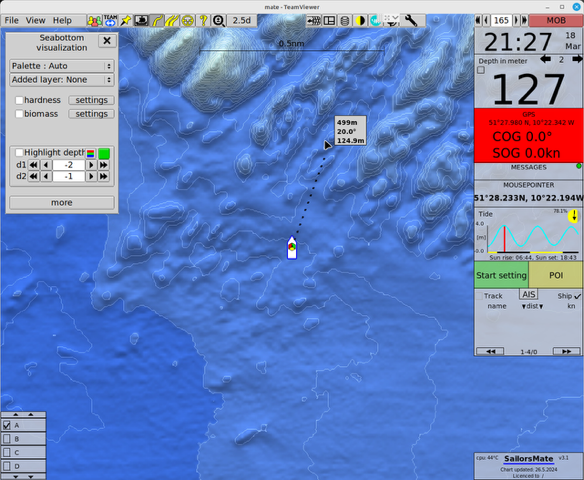
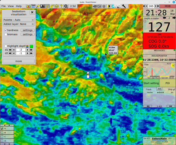
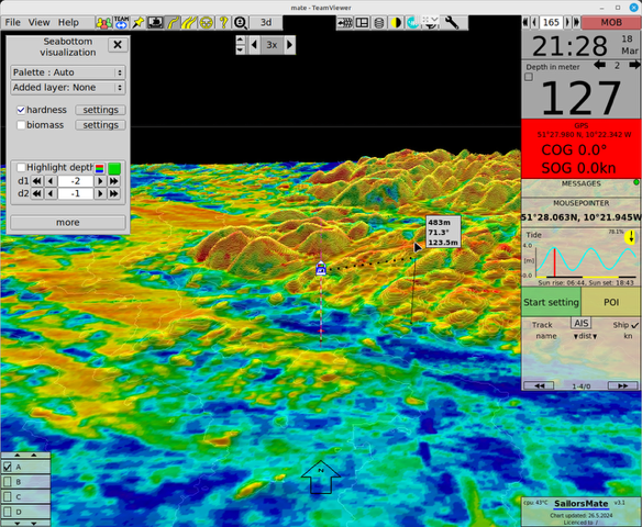
SailorsMate SailorsMate is a Norwegian-built computer plotter designed for fishing and work vessels. Developed in close collaboration with fishermen along Norway’s rugged coastlines, the system combines navigation, weather and vessel-stability tools with advanced seabed mapping. When used with Ireland’s INFOMAR and Geological Survey Ireland (GSI) seabed datasets, SailorsMate gives Irish vessels a powerful, practical tool for working safely and efficiently around the Irish coastline. SailorsMate + INFOMAR/GSI By integrating INFOMAR bathymetric charts and GSI sediment and substrate information, SailorsMate can display detailed seabed conditions directly on the plotter – including hardness and bottom type such as soft mud, sand, gravel or hard rock.
For Irish fishing fleets and offshore operators, this means safer operations, reduced gear losses and smarter use of local fishing grounds, using the same bridge plotter that crews are already familiar with. Example SailorsMate Screens
|
|
|||||||||
|
|
HOME | ABOUT US | SERVICES | CONTACT |
|
||||||||